Research Projects & Works
Showcasing my key research contributions and projects.

Satellite data to develop deep learning models for Building Categorization
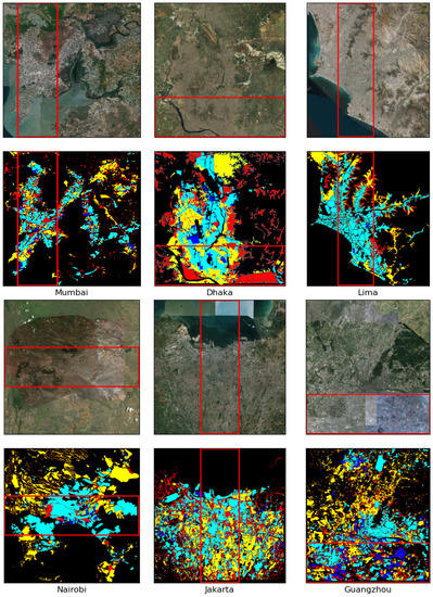
Objective: Finding the efficacy of a novel urban categorization framework based on deep learning, and a novel categorization method customized for cities in the global south.
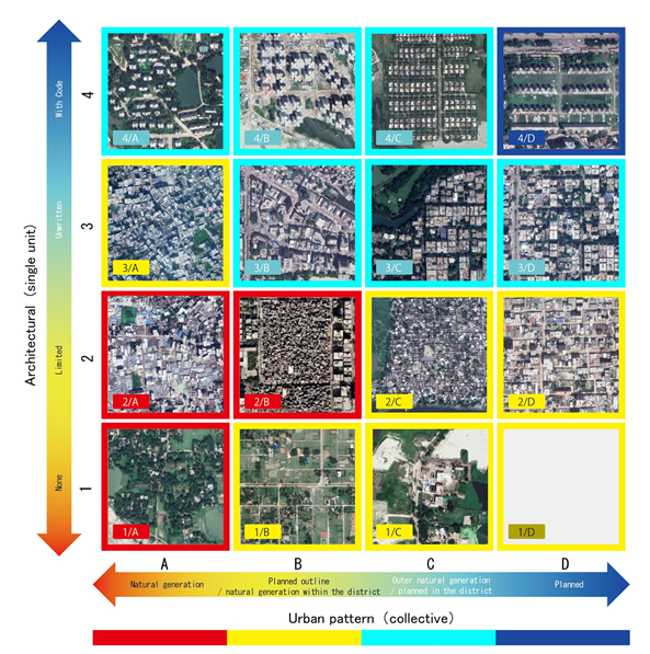
Approach: Each urban space was divided into four socioeconomic categories: (1) highly informal area; (2) moderately informal area; (3) moderately formal area, and (4) highly formal area.
Results: The model can segment the test part of every city with an average accuracy of 91.57%

Deep-Learning Coupled with Novel Classification for Urban Environment Classification in Developing Regions
Objective: The project focused on tackling the challenge of accurately classifying and understanding the urban environment in developing countries. This research aimed to improve urban planning and management through advanced data analysis.
Approach: We utilized deep learning models alongside a novel classification method. The approach involved combining satellite imagery and ground-based data with advanced machine learning techniques to classify various aspects of urban environments. The project leveraged tools like convolutional neural networks (CNNs) and geospatial analysis to handle large-scale environmental data.
Results: The project resulted in the development of a classification system capable of distinguishing different urban features with high accuracy. This has the potential to significantly improve urban infrastructure planning, reduce inefficiencies in resource allocation, and assist policymakers in better managing urban growth in developing regions.

LULC Segmentation of RGB Satellite Image Using FCN-8
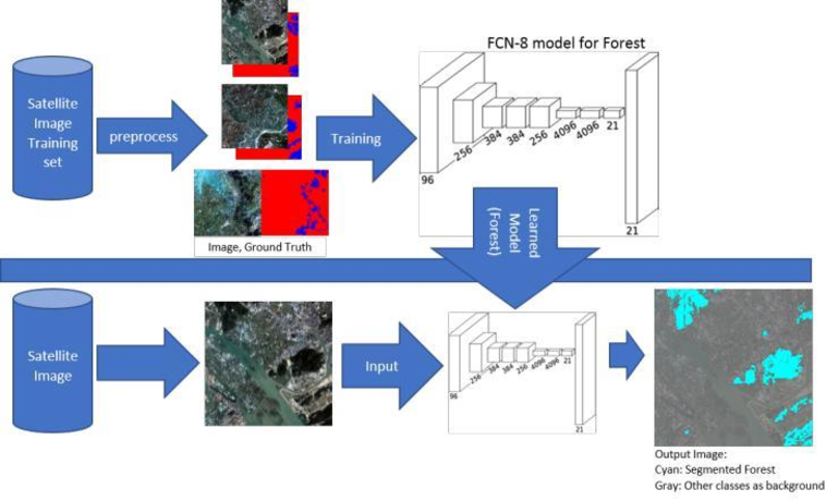
Objective: The project focused on the segmentation of high-resolution RGB satellite images into land use land cover (LULC) categories using fully convolutional networks (FCN-8).
Approach: We employed the FCN-8 model with VGG-16 weights to semantically segment images into forest, built-up, farmland, and water categories. A non-overlapping grid-based method was used for training.
Results: The model achieved an accuracy of 91% and an Intersection over Union (IoU) of 0.84, surpassing traditional GIS software. This work enhances satellite image classification accuracy.